Straubing
| Land: | Deutschland |
| Bundesland: | Bayern |
| Postleitzahl: | 94315 |
| Vorwahl: | 09421 |
| Kfz-Kennzeichen: | SR |
| Einwohner: | 44.741 |
| Webseite: | https://www.straubing.de/ |
| Wikipedia: | https://de.wikipedia.org/wiki/de:Straubing |
Straubing ist eine kreisfreie Stadt im Regierungsbezirk Niederbayern in Ostbayern mit 49.164 Einwohnern (Stand: 31. Dezember 2022). Im späten Mittelalter war die Stadt neben München, Landshut und Ingolstadt eine der Hauptstädte der bayerischen Teilherzogtümer, was sich in der Architektur bis heute widerspiegelt. Heute ist Straubing eines von vier niederbayerischen Oberzentren und Verwaltungssitz der Planungsregion Donau-Wald. Die Mittelstadt ist Sitz des Landratsamtes Straubing-Bogen und die größte Stadt im Gäuboden. Stadtpläne und Landkarten vom Stadtplandienst helfen Ihnen dabei, sich in Straubing zu orientieren. Sie können die Karten im Internet aufrufen und sich interessante Orte von Straubing anzeigen lassen, wie z. B. Sehenswürdigkeiten oder auch Tankstellen, Geldautomaten, Imbisse usw. Ausgedruckt können Sie den Stadtplan von Straubing auch offline nutzen.
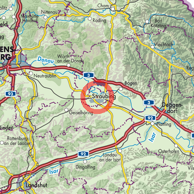
Städte und Gemeinden in der Nähe:
Parkstetten Aiterhofen Feldkirchen Aiterhofen (VGem) Atting Rain (VGem) Rain Kirchroth Salching Steinach Perkam Aholfing Oberschneiding
Parkstetten Aiterhofen Feldkirchen Aiterhofen (VGem) Atting Rain (VGem) Rain Kirchroth Salching Steinach Perkam Aholfing Oberschneiding
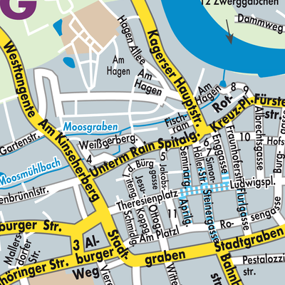
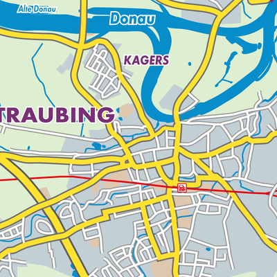
Stadtplan und Landkarte von Straubing
Klicken Sie auf die Karte, um zum Stadtplandienst zu gelangen.